IBR Modified LPA
What is the Modified LPA?
The Modified Locally Preferred Alternative (LPA) refers to an agreed upon set of components that will be further evaluated through the environmental review process. It is NOT the replacement bridge’s final design but rather a key milestone setting the program's direction as we start to test and evaluate plans for a replacement multimodal river crossing system.
Elements of the Modified LPA under analysis include:
- A new pair of Columbia River bridges built west of the existing bridge. Three bridge configuration options are under consideration: single-level fixed-span, double-deck fixed-span, and single-level movable-span.
- Improvements to the I-5 mainline and seven interchanges, north and south of the Columbia River, including options with or without C Street ramps and I-5 alignment options in downtown Vancouver, as well as related enhancements to the local street network.
- Extension of light rail from the Expo Center in Portland to Evergreen Boulevard in Vancouver, along with associated transit improvements, including transit stations at Hayden Island, Vancouver Waterfront, and near Evergreen Boulevard and options for park and ride locations in Vancouver.
- One or two auxiliary lane(s) in each direction and safety shoulders on the bridge.
- A variety of improvements for people who walk, bike and roll throughout the program area.
- Variable rate tolling for motorists using the river crossing as a demand management and financing tool.
What we learn from the review process, and corresponding environmental studies, will determine how we move forward, and necessary work to avoid, minimize or mitigate negative effects to our environment. This process will include opportunities for review and public comment and will inform the design refinements and decisions.
Program Visualizations
The following 3D videos show program investments and design options being studied.
Bird’s Eye View of I-5 Interchanges in Program Area
NB I-5 – Single-level, Fixed-span Steel Girder Bridges, 1 Auxiliary Lane and C St Ramps
SB I-5 – Single-level, Fixed-span Extradosed Bridges, 1 Auxiliary Lane and C St Ramps
NB I-5 – Single-level, Fixed-span Extradosed Bridges, 1 Auxiliary Lane and No C St Ramps
SB I-5 – Single-level, Fixed-span Steel Girder Bridges, 1 Auxiliary Lane and No C St Ramps
NB I-5 – Double-deck, Fixed-span Truss Bridges, 2 Auxiliary Lanes and C St Ramps
SB I-5 – Double-deck, Fixed-span Truss Bridges, 2 Auxiliary Lanes and C St Ramps
Modified LPA and Program Components
The following components are being analyzed as part of the National Environmental Policy Act (NEPA) process and may be modified by the environmental evaluation and public input. In some instances, multiple design concepts are being studied (e.g., park and ride locations and roadway alignment) to better understand the range of impacts and better optimize the design to avoid environmental resources.
All images shown are conceptual for the purpose of analysis and do not represent final design.
To view a roll map of the program corridor, click here*.
To view a roll map of active transportation improvements, click here*.
*Remediation available upon request.
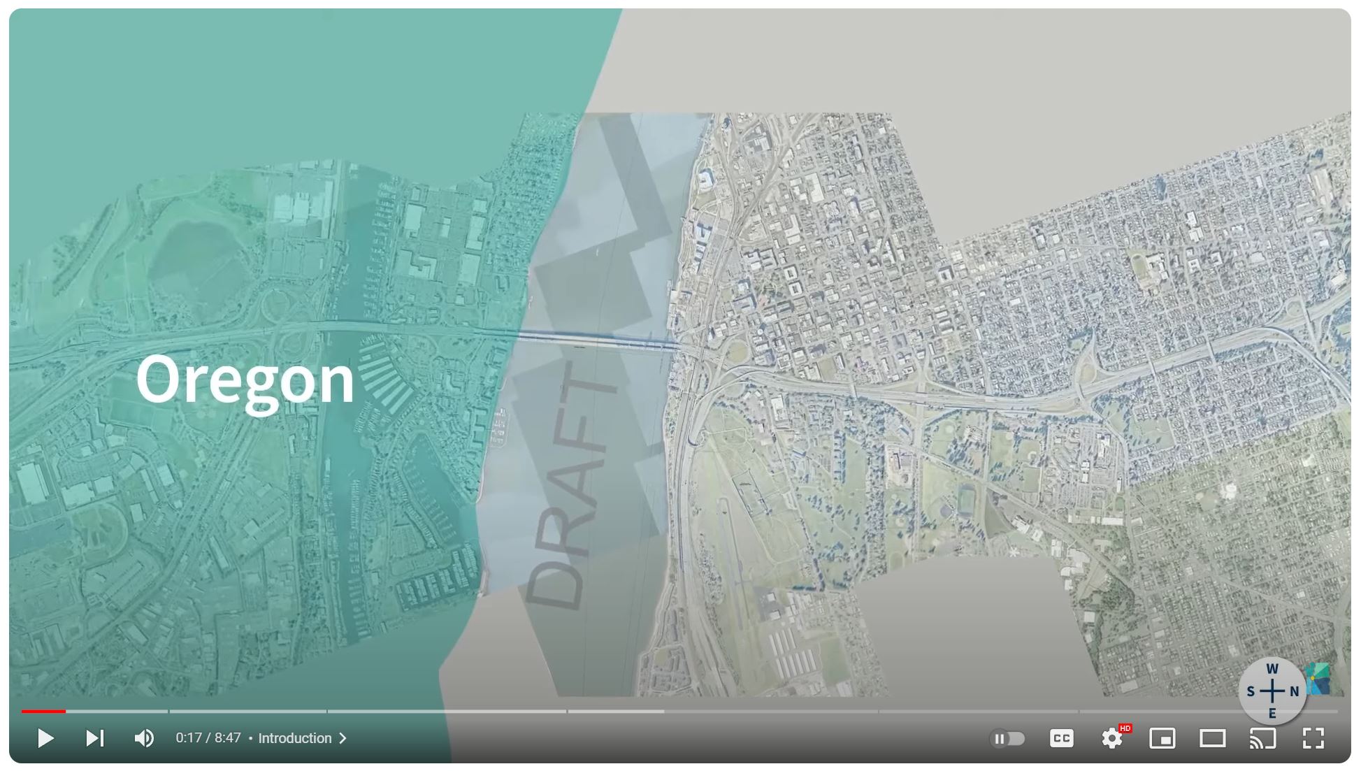
Oregon | Existing Conditions & Proposed Investments
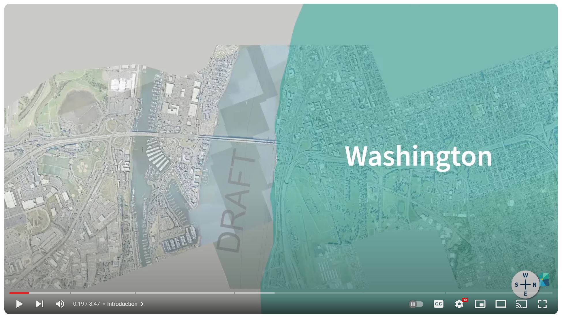
Washington | Existing Conditions & Proposed Investments
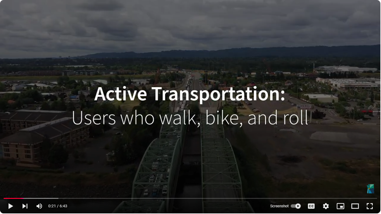
Active Transportation | Proposed Investments
Portland and Hayden Island
Program investments in this area will include upgrades to roadways, shared-use paths and public transit. That includes the extension of light rail from the Expo Center and a new transit station on Hayden Island, as well as dedicated lanes for express bus on shoulder across the river. A rebuilt interchange at I-5 and Marine Drive paired with new auxiliary lanes will help alleviate congestion and equalize the flow of traffic on and off the freeway. A new arterial bridge will make it so local traffic does not have to use the freeway to access the island. Investments in transit stations and roadway improvements underneath I-5 will help sew the community back together by removing the freeway as a barrier to mobility for pedestrians and transit users. Improvements to connections for bikes and pedestrians will link to a robust network of regional trails on both sides of the river. Improvements to the interchange at Victory Boulevard will lengthen the on-ramp to untangle merging northbound traffic entering I-5. Southbound traffic entering the freeway from Marine Drive would also see a lengthened approach and merge with I-5 south of Victory Boulevard.
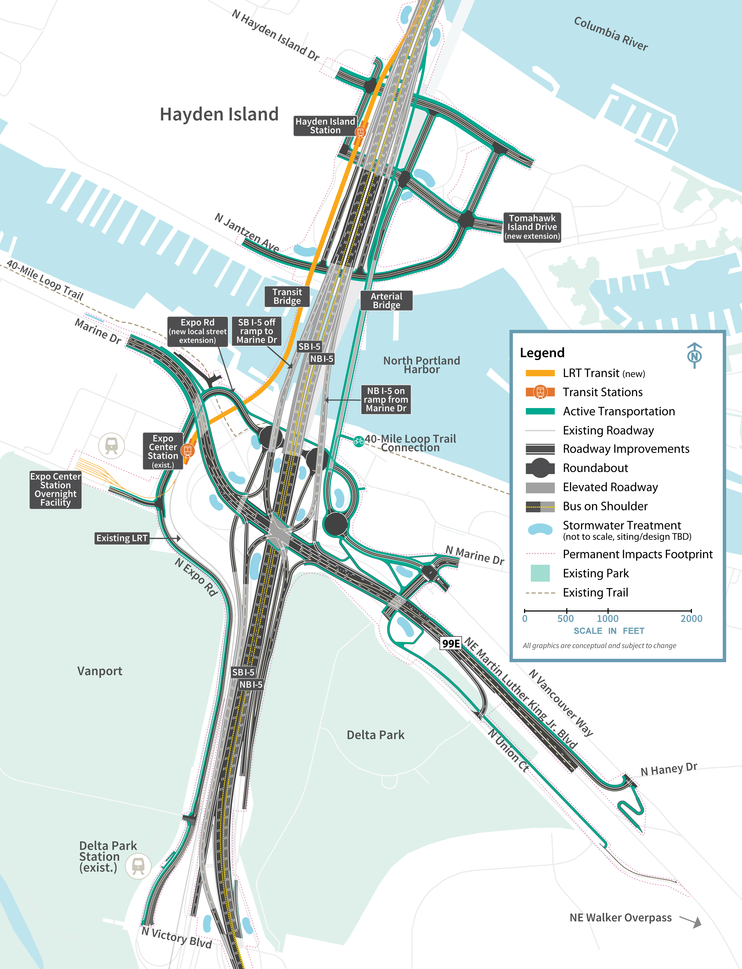
Click image to enlarge
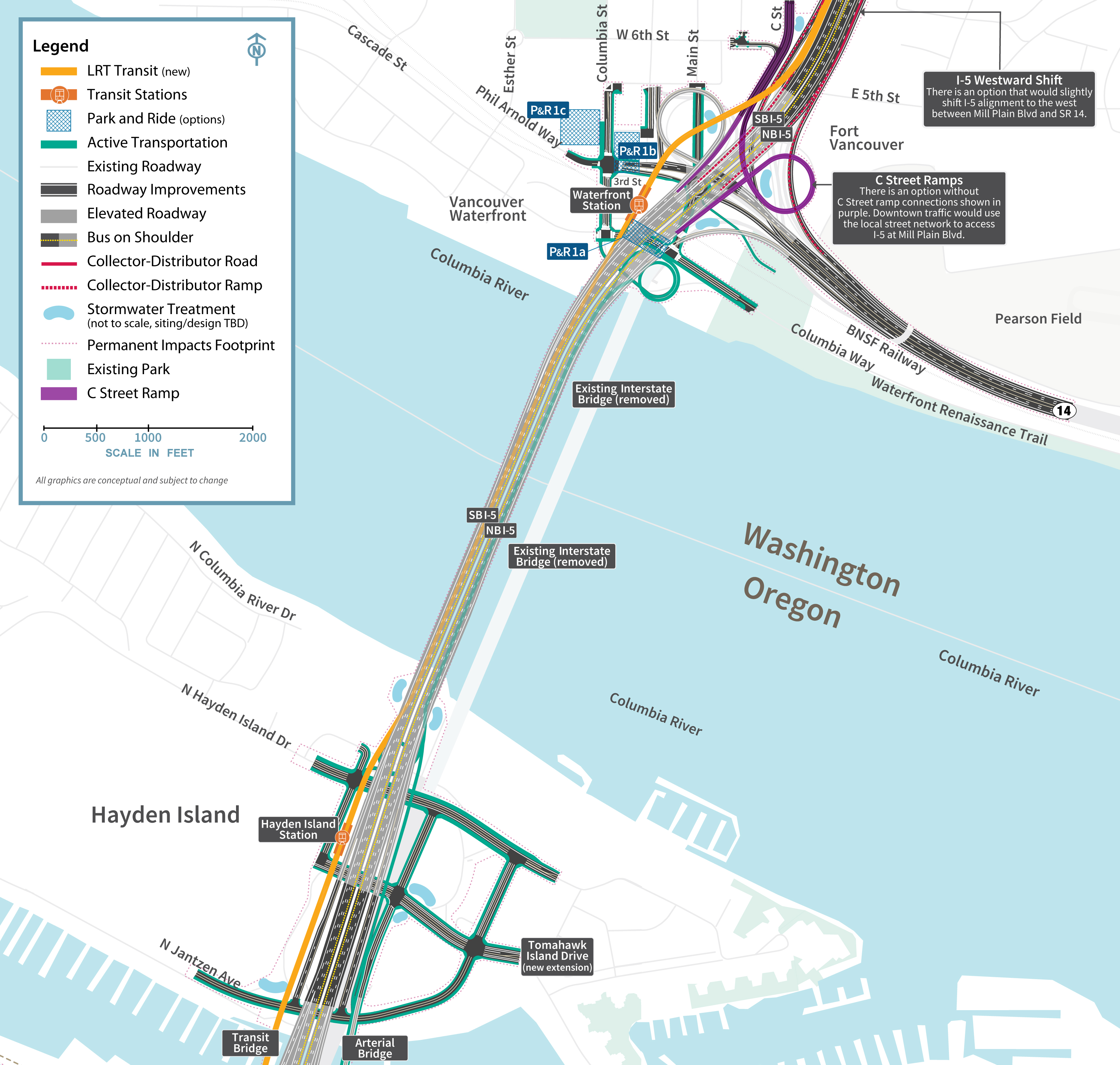
Columbia River Bridges
The replacement bridges will be safer and more accessible for freight and vehicles driving over the bridge, pedestrians and bike users. It will improve reliability for transit users across multiple modes, including light rail and express bus on shoulder. Whereas the existing bridges each have three lanes with no shoulders, the replacement bridge will be wide enough for three through lanes, one or two auxiliary lanes in each direction, and shoulders on both sides of the roadway to improve safety and improve reliability for vehicle and freight traffic. Rebuilt adjacent interchanges on Hayden Island and downtown Vancouver will provide easier access for traffic to connect local roads such as Hayden Island Drive and C Street, and SR 14. The program is also studying different bridge configurations including a single-level fixed-span, double-deck fixed-span and single-level movable-span. All bridge configurations would include two side-by-side bridges. The new eastern bridge would accommodate northbound traffic and a shared-use path, while the new western bridge would carry southbound traffic and two-way light rail. The bridge height will provide clearance for river traffic to safely navigate the channel below. Options under analysis include a fixed height of 116 feet, or a movable-span with a height of 178 feet in the open position.
Click image to enlarge
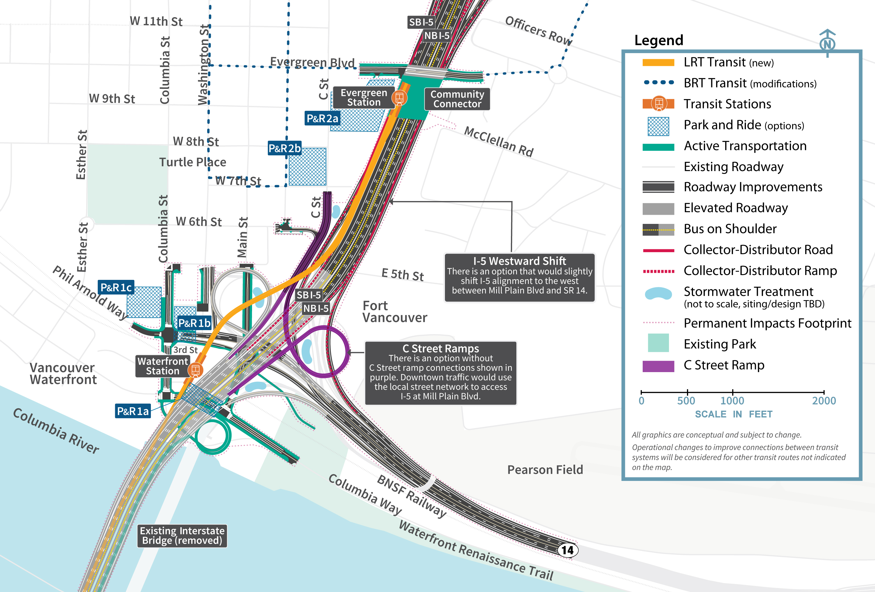
Downtown Vancouver
A waterfront light rail station will drop riders right onto the front doorstep of a booming downtown scene, while links to shared-use paths provide seamless mobility for active transportation users. Potential Park & Ride lots give hybrid options for travelers to use multiple modes of transportation to reach their end destinations. A community connector would essentially cap a portion of I-5 at Evergreen Boulevard to help sew opposing sides of the freeway back together into a seamless community for all users. A transit station near Evergreen Boulevard would also give riders access to the new light rail extension and dozens of local and regional bus routes.
Click image to enlarge
Upper Vancouver
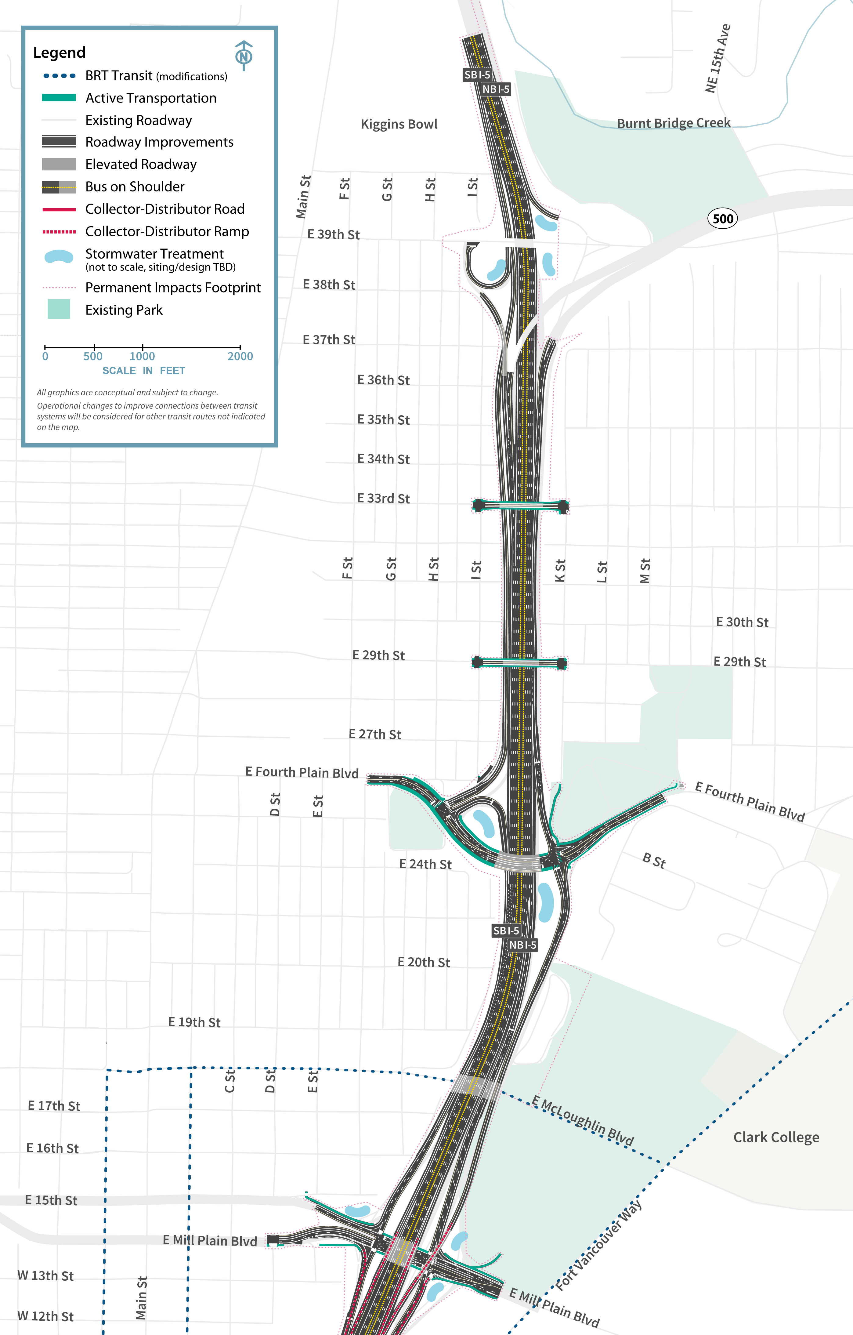
Reconstructed interchanges at Mill Plain Boulevard and Fourth Plain Boulevard will more efficiently facilitate traffic flow, including tall and wide freight traffic frequently traveling to and from the Port of Vancouver. Reconfiguration would preserve access from Mill Plain to Fourth Plain via a collector-distributor roadway, with the northbound off-ramp to Fourth Plain crossing over Mill Plain east of the freeway and functioning how it does currently. The overpasses at Fourth Plain Boulevard, 29th and 33rd Streets will also be reconstructed to be safer for pedestrian and bike users. Improvements to the I-5-SR 500 interchange include reconstruction of the interchange to establish the beginning of the braided ramp to Fourth Plain and restoration of the loop connecting southbound freeway traffic to SR 500 via 39th Street.
Click image to enlarge
Next Steps
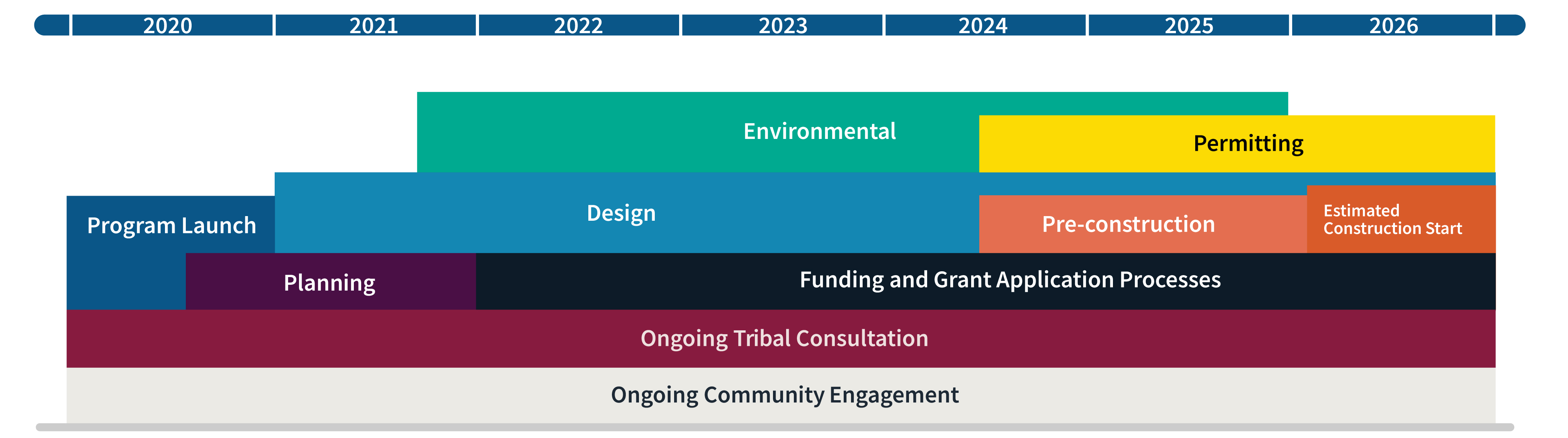
The Modified LPA and program area improvements are currently undergoing environmental evaluation as required by the National Environmental Policy Act (NEPA) to better understand benefits and impacts. In September 2024, the IBR program published a Draft Supplemental Environmental Impact Statement to disclose the findings of the environmental evaluation.
The document was available to the public for review and comment from September 20 - November 18. The public comment window included community events to share findings and answer questions. After the public comment period, the Modified LPA may be refined to address public comments, identify mitigation, and confirm a corridor-wide alternative. Following this, a Final Supplemental Environmental Impact Statement and Amended Record of Decision are anticipated to be issued in 2025/2026 by the Federal Highway Administration and Federal Transit Administration. The program will then move into the construction phase.
Learn more
- IBR Recommendation for Modified LPA - Summary Memo*
- IBR Recommendation for Modified LPA - Briefing Packet*
- IBR Recommendation - Summary Graphic
- Program Milestones
*Remediated versions available upon request.
Program Factsheets
Design Options that were Evaluated
Transit Investments
Transit investments have a unique set of data and analysis to inform decision-making and identify how each transit option performs. Analysis and modeling include measures such as ridership, travel time, reliability and costs, among others. The transit options were screened to understand how they perform against the program’s climate and equity goals.
Light Rail Transit (LRT) currently operates in Portland, with the Yellow Line terminating at Expo Center, near the southern border of the program area. Bus Rapid Transit (BRT) currently operates in Vancouver as The Vine, with its southern-most stop located at Turtle Place in downtown Vancouver.
Equity considerations: Station locations, mobility improvements and property impacts are all key considerations in the development of transit options.
Climate considerations: All options increase transit choices for interstate travel in the program area.
The IBR program analyzed the following transit options:
Four potential light rail transit options could extend the Yellow Line from the Expo Center in North Portland into Vancouver. All of these options would also feature express bus service between the two cities.
- The 2013 LPA – LRT would extend from the Expo Center in Portland to a terminus (end point) near Clark College in Vancouver. This option would include five new transit stations: one near McLoughlin/I-5, three in the Vancouver Central Business District and one on Hayden Island.
- LRT One Station in Vancouver – LRT would extend from the Expo Center in Portland to Turtle Place in Vancouver. This option would include two new transit stations: one on Hayden Island and one terminus near Turtle Place.
- LRT Hugging I-5 to Near McLoughlin – LRT would extend from the Expo Center to McLoughlin Boulevard in Vancouver via a dedicated guideway adjacent to I-5. This option would include three new stations: Hayden Island, Evergreen Boulevard and a terminus near McLoughlin/I-5.
- LRT Hugging I-5 to Kiggins Bowl – LRT would extend from the Expo Center to Kiggins Bowl just north of State Route 500 in a dedicated guideway adjacent to I-5. This option would include five new stations: Hayden Island, Evergreen Boulevard, McLoughlin Boulevard/I-5, 33rd Street and a terminus near Kiggins Bowl.
Three potential bus rapid transit options could extend C-TRAN’s Vine from Vancouver into Portland. All of these options would also feature express bus service between the cities.
- Dedicated BRT Turtle to Expo – Vine BRT lines would extend via a dedicated guideway from Turtle Place in Vancouver to a terminus near the Expo Center in Portland. This option would include three stations: one near Turtle Place, one on Hayden Island, and another near the Expo Center.
- Dedicated BRT Hugging I-5 – Vine BRT lines would extend via a dedicated guideway from Kiggins Bowl south to the MAX Expo Center Station on a dedicated guideway adjacent to I-5. This option would include six stations: near Kiggins Bowl, 33rd Street, McLoughlin/I-5, Evergreen Boulevard, Hayden Island and the Expo Center.
- Dedicated BRT through the Central Business District – Vine BRT lines would extend via dedicated guideway from McLoughlin Boulevard through Vancouver’s Central Business District before crossing the river to Hayden Island with a terminus near the Expo Center. This option would include six stations: one near McLoughlin/I-5, three in the Vancouver Central Business District, one on Hayden Island and one at Expo Center.
Additional options:
- Option L – Light Rail Transit, hugging I-5, would extend from the Expo Center in Portland to a terminus near McLoughlin Blvd in Vancouver, close to I-5. Potential station locations include Hayden Island, Columbia St./Columbia Way near the Vancouver waterfront, and Evergreen Blvd.
View a map showing option - Option M – Light Rail Transit, hugging I-5, would extend from the Expo Center in Portland to a terminus near Evergreen Blvd in Vancouver, close to I-5. Potential station locations include Hayden Island and Columbia St./Columbia Way near the Vancouver waterfront.
View a map showing option - The Dedicated BRT and LRT to Hayden Island is a hybrid option where Vine BRT lines would extend via a dedicated guideway from a station near Turtle Place in Vancouver to a terminus on Hayden Island. The MAX Yellow Line would extend from the current terminus at the Expo Center to a new terminus on Hayden Island.
View a map showing option. - The Bus on Shoulder Option assumes C-TRAN express routes 101 and 105X operate as bus on shoulder in the bridge influence area (both directions). Route 101 operates from downtown Vancouver to downtown Portland, Route 105X operates from the Salmon Creek Park & Ride (with a stop at the 99th Street Transit Center) to downtown Portland.
View a map showing option. - Finally, there is a No-Build Option that assumes no transit improvement from the IBR program but does include other planned transit improvements in the next 25 years. This option is used as a tool for measuring the effects of other options.
Preliminary details regarding park and ride station locations were developed to better understand trade-offs associated with each of the possible transit investments and do not represent design decisions. Decisions about station and park and ride size and locations will be made after further analysis and input from the community.
Hayden Island/Marine Drive
In October 2022, the IBR program shared a list of preliminary design options created in response to changes within the Interstate Bridge corridor since previous planning efforts. Full, partial, and no interchange options for Hayden Island were developed, alongside improvement considerations for Marine Drive. All options assumed:
- Replacement of the North Portland Harbor bridge connecting North Portland to Hayden Island on I-5
- A new local vehicle access bridge from North Portland to Hayden Island
- A new high-capacity transit station on Hayden Island
- Improved pedestrian and bicycle connections from the Interstate Bridge shared-use paths
Initial screening of design options reveals having no I-5 interchange on Hayden Island is not a viable solution. Traffic would be forced to use the Marine Drive interchange to access Hayden Island, resulting in substantial impacts on freight and passenger traffic. Ramp queuing from Marine Drive onto I-5 creates unsafe safety conditions due to speed differential with I-5 through traffic.
Full and partial interchange options were recommended for further consideration and evaluation. The primary differences between these options? Footprint and access.
Full interchange on Hayden Island:
- Larger footprint over North Portland Harbor
- More impacts to personal and commercial properties
- Hayden Island vehicle/freight access to/from Portland via Hayden Island Drive I-5 ramps
- Larger scale/complexity of I-5 over Hayden Island provides lower quality experience for active transportation and transit access on east-west streets
Partial interchange on Hayden Island:
- Smaller footprint over North Portland Harbor
- Fewer impacts to personal and commercial properties
- Hayden Island vehicle/freight access to/from Portland via local roads and I-5 ramps that cross under Marine Drive
- Smaller scale/complexity of I-5 over Hayden Island provides higher quality experience for active transportation and transit access on east-west streets
River Crossing
The design options being considered include variations designed for a two-bridge or one-bridge river crossing. Analysis includes measures such as ease of interchange connection with Interstate 5, geometry of freeway interchange ramps, integration with active transportation and environmental impacts, among others.
All configurations include the replacement of the North Portland Harbor bridge, which is needed for consistent seismic resiliency throughout the program area.
Seismic retrofitting of the North Portland Harbor Bridge is not cost effective based on the age of the bridge and the known costs of recent seismic retrofits. In addition, a retrofit cannot achieve the same resiliency as new construction.
Equity and Climate considerations: All options provide dedicated transit guideway and dedicated wide shared-use path to create appealing and effective transit and active transportation opportunities. Exposure to noise – of particular importance to pedestrians who are blind or visually impaired and rely heavily on sound to navigate – could differ between the options. Options may also carry different implications in terms of displacement or other impacts to houseless populations living in the area. Current and future river conditions are taken into consideration.
The IBR program is analyzing the following river crossing options:
- The 2013 LPA Option has two bridges and a curved alignment, with highway lanes on the top level and dedicated transit guideway and a shared-use path on the bottom level.
- Technical considerations: This option provides a narrowed footprint, with the transit and shared-use path under the highway (in comparison with all modes on one level). The curved alignment connects the new bridge to the existing North Portland Harbor bridge and the existing highway corridor in Vancouver.
- The One Bridge Option consolidates all elements into one bridge, with southbound highway lanes on top of northbound highway lanes. Transit and the shared-use path would be on the lower level on each side of the bridge.
- Technical considerations: This one-bridge solution would have a smaller footprint over the river and reduce the number of foundations in the water compared to the other options, thus minimizing impacts to the natural environment and surrounding areas.
- The Two Bridge Option removes the curve as much as possible while maintaining the two bridge/two-level highway over the transit/shared-use path.
- Technical considerations: The straight alignment is west of the Interstate 5 (I-5) corridor on Hayden Island. This alignment makes the North Portland Harbor Bridge replacement less complex. A straight alignment is less complex to construct than a curving structure.
Tolls on the Interstate Bridge
Tolling for the IBR program is anticipated to include variable priced tolling with the goal of funding construction and facility operations and maintenance, improving reliability and managing demand, encouraging the use of other modes of travel and off-peak travel, and reducing optional trips.
Toll rate and policy setting for the Interstate Bridge rests with the transportation commissions in Oregon and Washington. In early 2024, both commissions approved an agreement that stands up an I-5 bridge bi-state toll subcommittee. The subcommittee is made up of two commissioners from each state and will jointly recommend toll rates and policies, including potential discounts, to each state’s respective full Commissions. The IBR program has studied several potential toll scenarios, including consideration of a low-income toll discount, with input from the transportation commissions, in the toll traffic and revenue analysis completed in late 2023. These scenarios are not final rates but will inform future rate setting. The commissions’ adoption of toll rates is not anticipated to occur until shortly before tolling is estimated to begin on the facility. The earliest tolling is currently anticipated to start on the Interstate Bridge is in spring 2026.
To submit written public comment, please email info@bistatesubcommittee.org
You can learn more about the bi-state toll subcommittee, find meeting materials and view videos of past meetings on each commission’s website.
Oregon Transportation Commission toll subcommittee
Washington State Transportation Commission toll subcommittee
Sign up to receive updates on the bi-state subcommittee
Thank you for subscribing.
Program Components
Equity Framework
An essential first step of the IBR program’s commitment to centering equity is to develop a shared understanding of what the program seeks to achieve and how it will be accomplished. The IBR Equity Framework outlines the program’s approach and the resources it will use to advance equity.
Equity Framework
The Framework includes the program’s Equity Definition and Principles, Equity Objectives, Measures of Success and a Toolbox to assist in putting the Framework into action. The Framework is informed by the Equity Advisory Group (EAG), community input, program staff insight and best practices and language from other projects' equity frameworks and toolkits.
The IBR Equity Framework is intended to guide every element of the program. From planning, design, and environmental review to community engagement, it will be applied to all critical decisions and actions.

Responsibility for honoring and implementing the Equity Framework is the collective responsibility of program leadership, staff, partners and advisory groups.
Climate Framework
Integrated with our commitment to equity is our commitment to supporting regional climate goals.
Climate Framework
The IBR Program is committed to four climate outcomes:
1. Reduce GHG in support of state climate goals
2. Minimize operational and embodied carbon during construction
3. Structures are resilient to climate disruptions
4. Limit environmental impacts that exacerbate effects of climate change
The IBR Climate Framework will help us achieve these outcomes through emphasizing design choices and construction practices that:
- Reduce climate impacts from transportation options selected for the program
- Reduce climate impacts associated with construction, including the materials and methods used
- Reduce climate impacts associated with maintenance and operation of a new bridge and multimodal facilities
- Create resilient infrastructure that endures in variable climate conditions and is adaptable to climate-driven environmental and community changes
- Apply an equity lens to climate concerns and climate actions
- Evaluate offsets to help mitigate unavoidable GHG emissions associated with the program
The Climate Framework is an integral part of the program and is a primary factor in the development of:
- Desired outcomes
- Design option screening criteria
- Bridge, highway and transit design
- Program-level performance measures
- Intergovernmental agreements and community benefits agreements
- Environmental impacts analysis and mitigation
- Construction specifications and procurement strategies
- Program commitments: community enhancements and mitigation
The IBR Program is working closely with local partner agencies in both states to align IBR’s Climate Framework and actions with the goals and aspirations of local agency climate plans.
Environmental Compliance
Environmental compliance is foundational to the program’s success. To achieve environmental compliance, the IBR program is committed to meeting federal, state and local laws and regulations for protecting the natural, built and cultural environment.
Environmental Compliance
The program will seek opportunities to enhance communities and the environment within the scope of the program activities.
Environmental work was previously completed for the Columbia River Crossing (CRC) project, including site evaluations and technical studies of various topics (e.g., fish and wildlife, climate, and parks and recreation). However, since 2013, there have been many changes to the physical environment, regulatory context and local jurisdictions’ and communities’ priorities. In response to those changes, the program will collect additional data and update its technical analyses as a part of the environmental process.
Examples of work that could still be valid or require minimal updates include geological conditions and land use. On the other hand, community demographics, visual impact assessments and the transportation studies are outdated and will be updated.
For more information, view our environmental compliance page.
Videos
Seismic Vulnerability
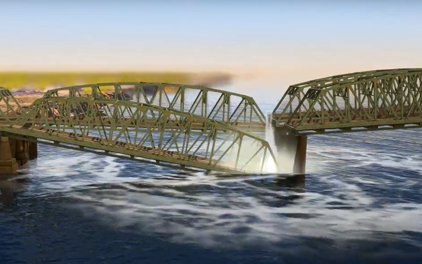
The Interstate Bridge is located near the Cascadia Subduction Zone, a 620-mile-long highly susceptible earthquake field. Learn more about how a major seismic event could affect the bridge.
Existing Conditions
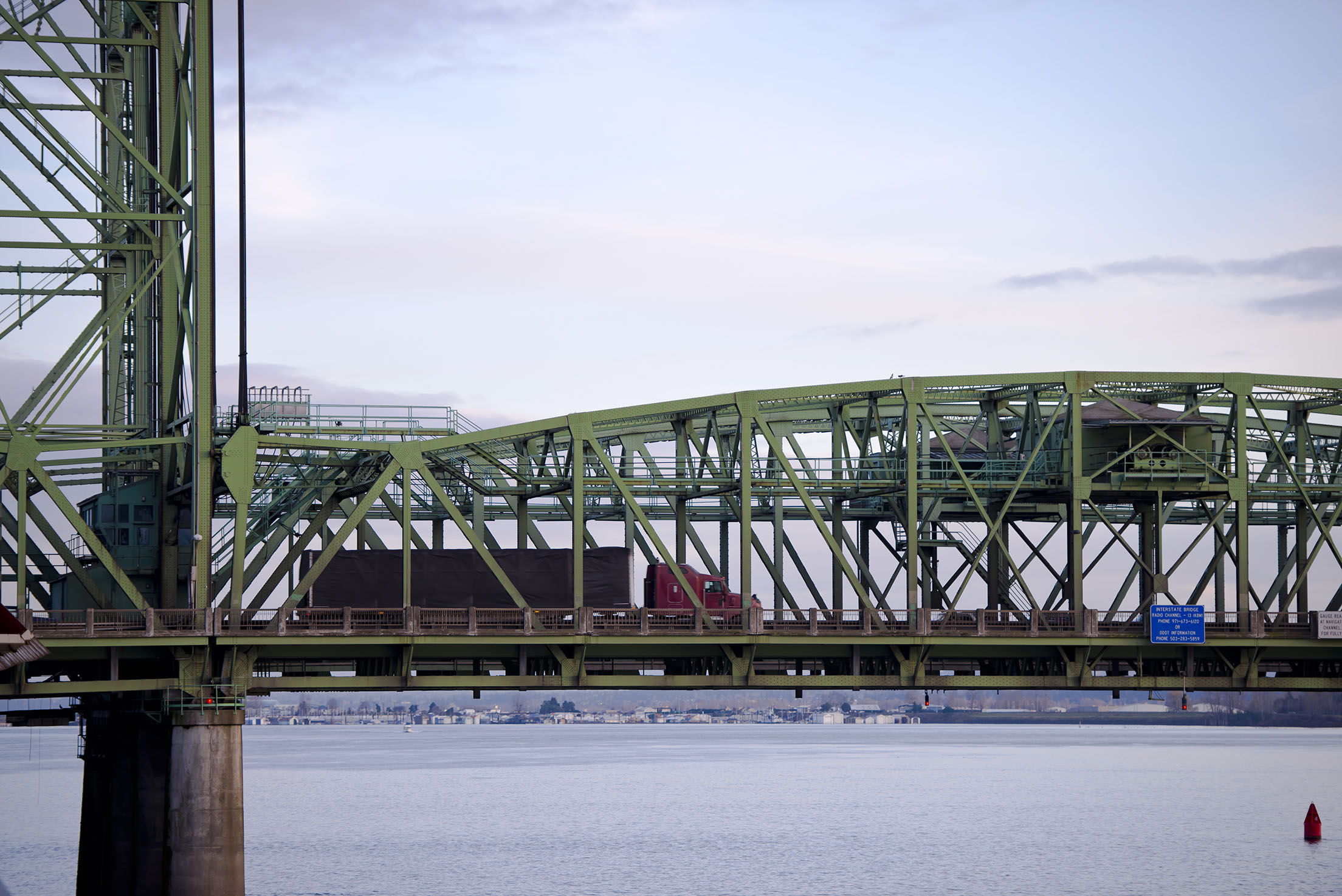
Located between Portland, OR and Vancouver, WA the Interstate Bridge is a vital connection that supports local jobs and families, and is a vital trade route for regional, national and international economies.
The Case for IBR
Provide Feedback
We need your help.
Join us in our effort to replace the Interstate Bridge. Your feedback is important in shaping a solution.
Submit a comment Share your story Attend a meeting