IBR Modified LPA
What is the Modified LPA?
The Modified Locally Preferred Alternative (LPA) refers to an agreed upon set of components that will be further evaluated through the environmental review process. It is NOT the replacement bridge’s final design but rather a key milestone setting the program's direction as we start to test and evaluate plans for a replacement multimodal river crossing system.
Elements of the Modified LPA under analysis include:
- A new pair of Columbia River bridges built west of the existing bridge. Three bridge configuration options are under consideration: single-level fixed-span, double-deck fixed-span, and single-level movable-span.
- Improvements to the I-5 mainline and seven interchanges, north and south of the Columbia River, including options with or without C Street ramps and I-5 alignment options in downtown Vancouver, as well as related enhancements to the local street network.
- Extension of light rail from the Expo Center in Portland to Evergreen Boulevard in Vancouver, along with associated transit improvements, including transit stations at Hayden Island, Vancouver Waterfront, and near Evergreen Boulevard and options for park and ride locations in Vancouver.
- One or two auxiliary lane(s) in each direction and safety shoulders on the bridge.
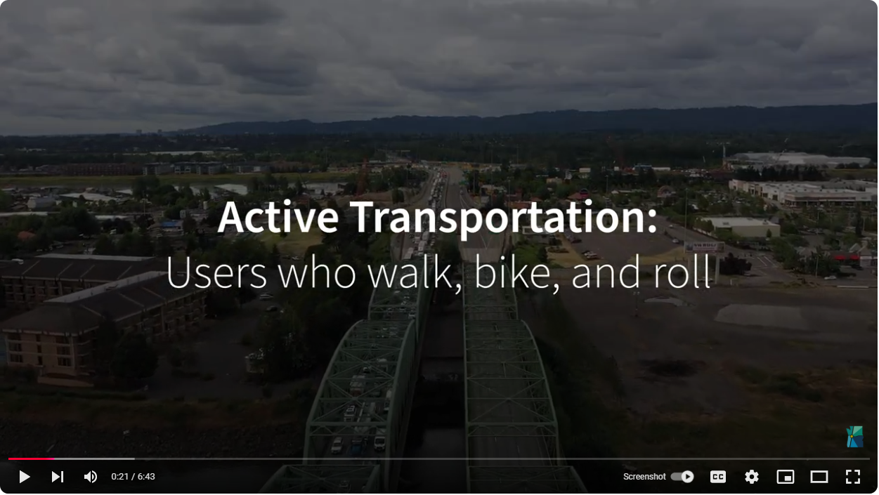
- A variety of improvements for people who walk, bike and roll throughout the program area.
- Variable rate tolling for motorists using the river crossing as a demand management and financing tool.
What we learn from the review process, and corresponding environmental studies, will determine how we move forward, and necessary work to avoid, minimize or mitigate negative effects to our environment. This process will include opportunities for review and public comment and will inform the design refinements and decisions.
Program Visualizations
The following 3D videos show program investments and design options being studied.
Bird’s Eye View of I-5 Interchanges in Program Area
NB I-5 – Single-level, Fixed-span Steel Girder Bridges, 1 Auxiliary Lane and C St Ramps
SB I-5 – Single-level, Fixed-span Extradosed Bridges, 1 Auxiliary Lane and C St Ramps
NB I-5 – Single-level, Fixed-span Extradosed Bridges, 1 Auxiliary Lane and No C St Ramps
SB I-5 – Single-level, Fixed-span Steel Girder Bridges, 1 Auxiliary Lane and No C St Ramps
NB I-5 – Double-deck, Fixed-span Truss Bridges, 2 Auxiliary Lanes and C St Ramps
SB I-5 – Double-deck, Fixed-span Truss Bridges, 2 Auxiliary Lanes and C St Ramps
Modified LPA and Program Components
The following components are being analyzed as part of the National Environmental Policy Act (NEPA) process and may be modified by the environmental evaluation and public input. In some instances, multiple design concepts are being studied (e.g., park and ride locations and roadway alignment) to better understand the range of impacts and better optimize the design to avoid environmental resources.
All images shown are conceptual for the purpose of analysis and do not represent final design.
To view a roll map of the program corridor, click here*.
To view a roll map of active transportation improvements, click here*.
*Remediation available upon request.
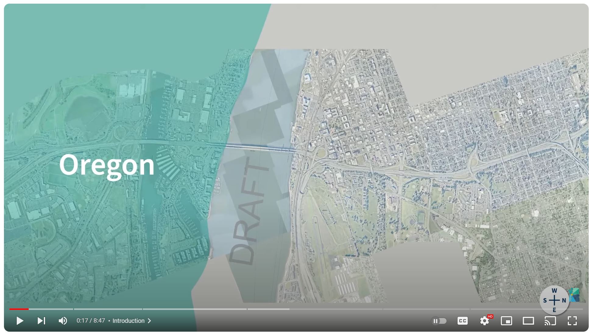
Oregon | Existing Conditions & Proposed Investments
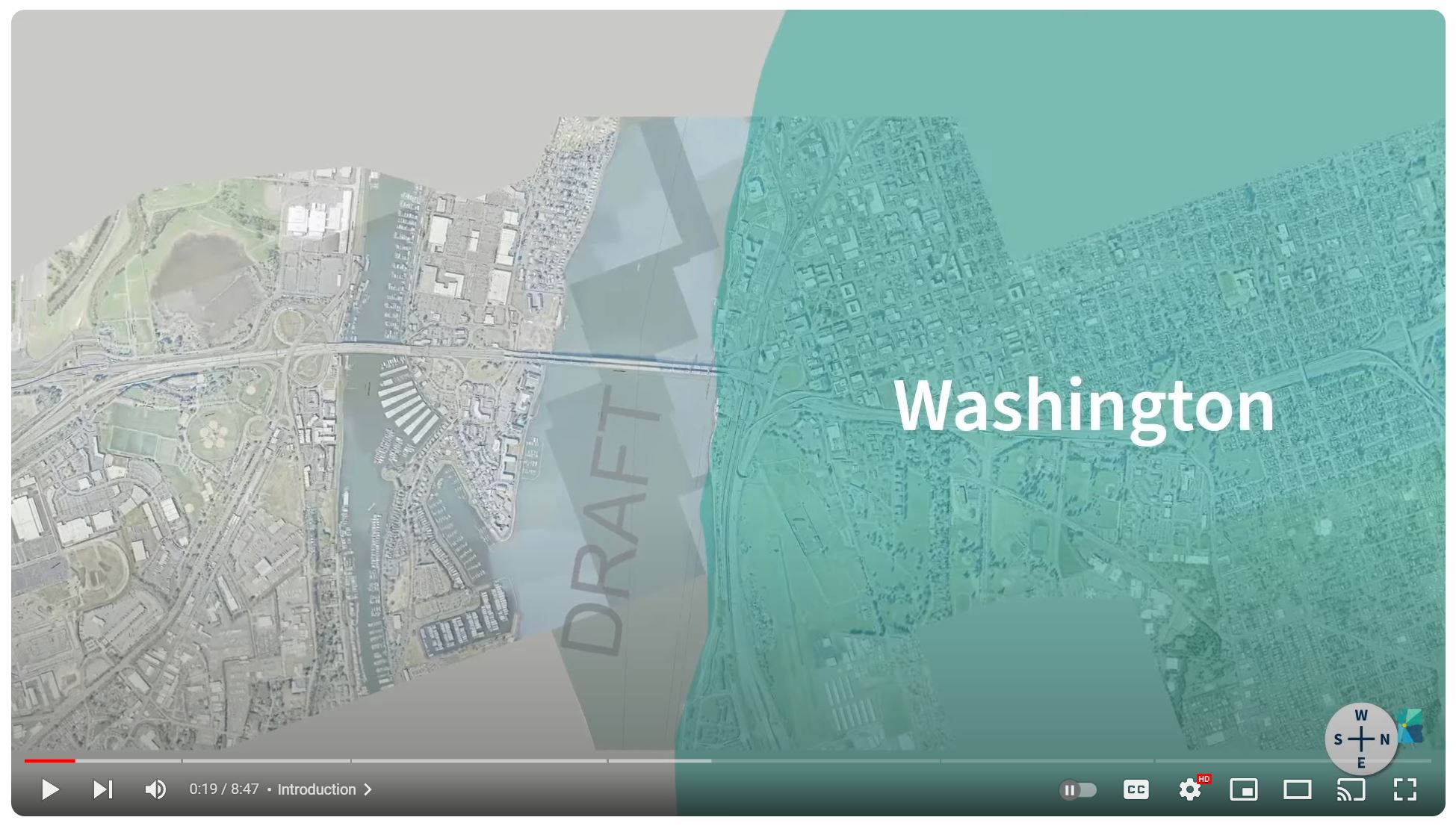
Washington | Existing Conditions & Proposed Investments
Active Transportation | Proposed Investments
Portland and Hayden Island
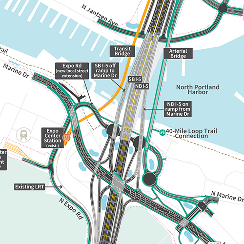
Program investments in this area will include upgrades to roadways, shared-use paths and public transit. That includes the extension of light rail from the Expo Center and a new transit station on Hayden Island, as well as dedicated lanes for express bus on shoulder across the river. A rebuilt interchange at I-5 and Marine Drive paired with new auxiliary lanes will help alleviate congestion and equalize the flow of traffic on and off the freeway. A new arterial bridge will make it so local traffic does not have to use the freeway to access the island. Investments in transit stations and roadway improvements underneath I-5 will help sew the community back together by removing the freeway as a barrier to mobility for pedestrians and transit users. Improvements to connections for bikes and pedestrians will link to a robust network of regional trails on both sides of the river. Improvements to the interchange at Victory Boulevard will lengthen the on-ramp to untangle merging northbound traffic entering I-5. Southbound traffic entering the freeway from Marine Drive would also see a lengthened approach and merge with I-5 south of Victory Boulevard.
Columbia River Bridges
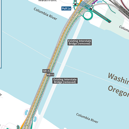
The replacement bridges will be safer and more accessible for freight and vehicles driving over the bridge, pedestrians and bike users. It will improve reliability for transit users across multiple modes, including light rail and express bus on shoulder. Whereas the existing bridges each have three lanes with no shoulders, the replacement bridge will be wide enough for three through lanes, one or two auxiliary lanes in each direction, and shoulders on both sides of the roadway to improve safety and improve reliability for vehicle and freight traffic. Rebuilt adjacent interchanges on Hayden Island and downtown Vancouver will provide easier access for traffic to connect local roads such as Hayden Island Drive and C Street, and SR 14. The program is also studying different bridge configurations including a single-level fixed-span, double-deck fixed-span and single-level movable-span. All bridge configurations would include two side-by-side bridges. The new eastern bridge would accommodate northbound traffic and a shared-use path, while the new western bridge would carry southbound traffic and two-way light rail. The bridge height will provide clearance for river traffic to safely navigate the channel below. Options under analysis include a fixed height of 116 feet, or a movable-span with a height of 178 feet in the open position.
Downtown Vancouver
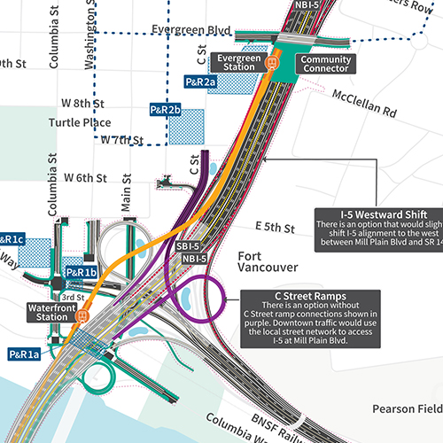
A waterfront light rail station will drop riders right onto the front doorstep of a booming downtown scene, while links to shared-use paths provide seamless mobility for active transportation users. Potential Park & Ride lots give hybrid options for travelers to use multiple modes of transportation to reach their end destinations. A community connector would essentially cap a portion of I-5 at Evergreen Boulevard to help sew opposing sides of the freeway back together into a seamless community for all users. A transit station near Evergreen Boulevard would also give riders access to the new light rail extension and dozens of local and regional bus routes.
Upper Vancouver
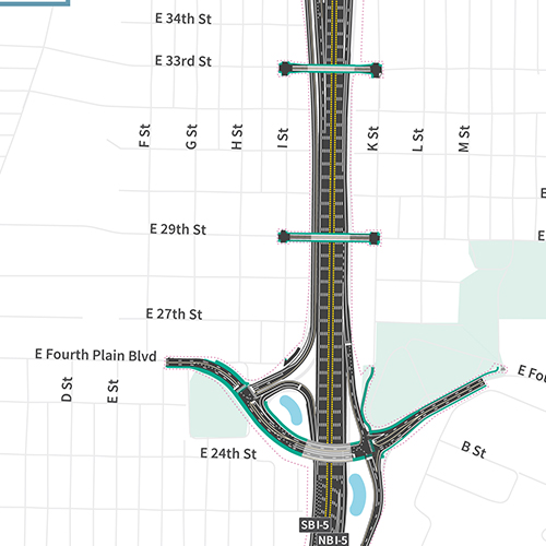
Reconstructed interchanges at Mill Plain Boulevard and Fourth Plain Boulevard will more efficiently facilitate traffic flow, including tall and wide freight traffic frequently traveling to and from the Port of Vancouver. Reconfiguration would preserve access from Mill Plain to Fourth Plain via a collector-distributor roadway, with the northbound off-ramp to Fourth Plain crossing over Mill Plain east of the freeway and functioning how it does currently. The overpasses at Fourth Plain Boulevard, 29th and 33rd Streets will also be reconstructed to be safer for pedestrian and bike users. Improvements to the I-5-SR 500 interchange include reconstruction of the interchange to establish the beginning of the braided ramp to Fourth Plain and restoration of the loop connecting southbound freeway traffic to SR 500 via 39th Street.
Next Steps
The Modified LPA and program area improvements are currently undergoing environmental evaluation as required by the National Environmental Policy Act (NEPA) to better understand benefits and impacts. In September 2024, the IBR program published a Draft Supplemental Environmental Impact Statement to disclose the findings of the environmental evaluation.
The document was available to the public for review and comment from September 20 through November 18. The public comment window included community events to share findings and answer questions. After the public comment period, the Modified LPA may be refined to address public comments, identify mitigation, and confirm a corridor-wide alternative. Following this, a Final Supplemental Environmental Impact Statement and Amended Record of Decision are anticipated to be issued in early 2026 by the Federal Highway Administration and Federal Transit Administration. The program will then move into the construction phase.

Videos
Seismic Vulnerability
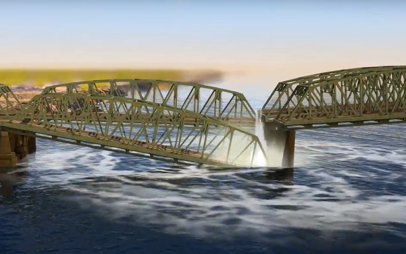
The Interstate Bridge is located near the Cascadia Subduction Zone, a 620-mile-long highly susceptible earthquake field. Learn more about how a major seismic event could affect the bridge.
Existing Conditions
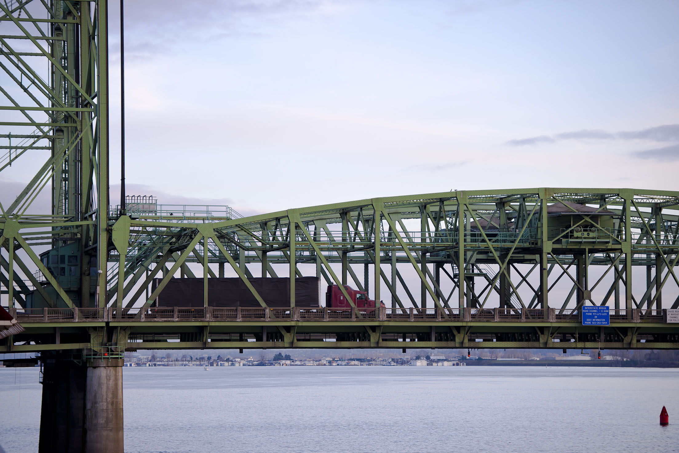
Located between Portland, OR and Vancouver, WA the Interstate Bridge is a vital connection that supports local jobs and families, and is a vital trade route for regional, national and international economies.
The Case for IBR
Provide Feedback
We need your help.
Join us in our effort to replace the Interstate Bridge. Your feedback is important in shaping a solution.
Submit a comment Share your story Attend a meeting

