Advancing to Construction
The Interstate Bridge Replacement Program is a joint effort between Oregon and Washington to replace the Interstate Bridge across the Columbia River and make improvements along Interstate 5 between Portland and Vancouver. Our goal is to build a modern, multimodal corridor that strengthens earthquake resiliency, improves safety, and keeps people and goods moving.
What are we building first?
The Program has approximately $5.7 billion in committed funding, which enables the Program to:
- Build the replacement bridge with a shared-use path, width for future construction of light rail, three through lanes, safety shoulders and one auxiliary lane in each direction for merging on and off Interstate 5
- Connect I-5 to the bridge in Oregon and Washington
- Connect SR 14 in Washington and Hayden Island in Oregon to I-5
- Construct tolling infrastructure
- Advance design of the light rail extension to the Vancouver Waterfront for future construction
- Remove the existing bridge
Pursuing these projects as a first funded phase is consistent with the investments studied through the federal environmental process. The estimated cost for this first funded phase of construction phase is $5.68 billion. While working toward construction of these investments, the Program is pursuing funding to construct light rail from North Portland to the Waterfront in Vancouver. This phase, and subsequent phases, will operate effectively and provide benefits to the traveling public independent of future phases of construction.
Investments proposed for the five-mile IBR Program corridor
Large, complex infrastructure projects across the country are often delivered in phases. Work begins on critical components that can move forward first, while additional pieces are constructed as funding becomes available. The states remain committed to building the investments proposed across the five-mile corridor over time.
The Program remains committed to pursuing the following investments in the five-mile corridor over time:
- A new, single-level fixed-span Columbia River bridge built west of the existing bridge
- Improvements to seven interchanges north and south of the Columbia River
- Extension of light rail from Portland to Vancouver and bus on shoulder express service
- One auxiliary lane in each direction for merging of and on I-5 and safety shoulders on the bridge
- Improvements for people who walk, bike and roll throughout the program area
- Variable rate tolling for motorists traveling over the Columbia River to pay for the new bridge and manage congestion
The Program’s environmental review process evaluated the impacts and benefits of these key investments to better understand how their construction would affect the natural and built environmental. The Program also identified necessary work to avoid, minimize and mitigate negative effects to our environment as part of the federal environmental review process. A list of these commitments is available in Appendix M of the Final Supplemental Environmental Impact Statement.
Program Visualizations
The following 3D videos show program investments and design options being studied.
Bird’s Eye View of I-5 Interchanges in Program Area
NB I-5 – Single-level, Fixed-span Steel Girder Bridges, 1 Auxiliary Lane and C St Ramps
SB I-5 – Single-level, Fixed-span Extradosed Bridges, 1 Auxiliary Lane and C St Ramps
NB I-5 – Single-level, Fixed-span Extradosed Bridges, 1 Auxiliary Lane and No C St Ramps
SB I-5 – Single-level, Fixed-span Steel Girder Bridges, 1 Auxiliary Lane and No C St Ramps
NB I-5 – Double-deck, Fixed-span Truss Bridges, 2 Auxiliary Lanes and C St Ramps
SB I-5 – Double-deck, Fixed-span Truss Bridges, 2 Auxiliary Lanes and C St Ramps
Modified LPA and Program Components
The following components were analyzed as part of the federal environmental review process. In some instances, multiple design concepts were studied (e.g., park and ride locations and roadway alignment) to better understand the range of impacts and better optimize the design to avoid environmental resources.
All images shown are conceptual for the purpose of analysis and do not represent final design.
- To view a roll map of the program corridor, click here*.
- To view a roll map of active transportation improvements, click here*.
*Remediation available upon request.
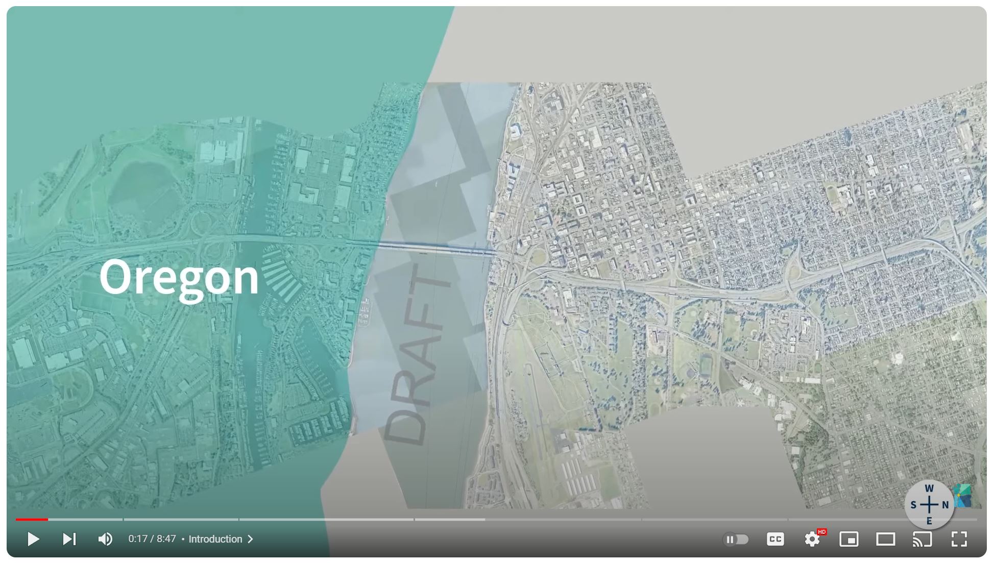
Oregon | Existing Conditions & Proposed Investments
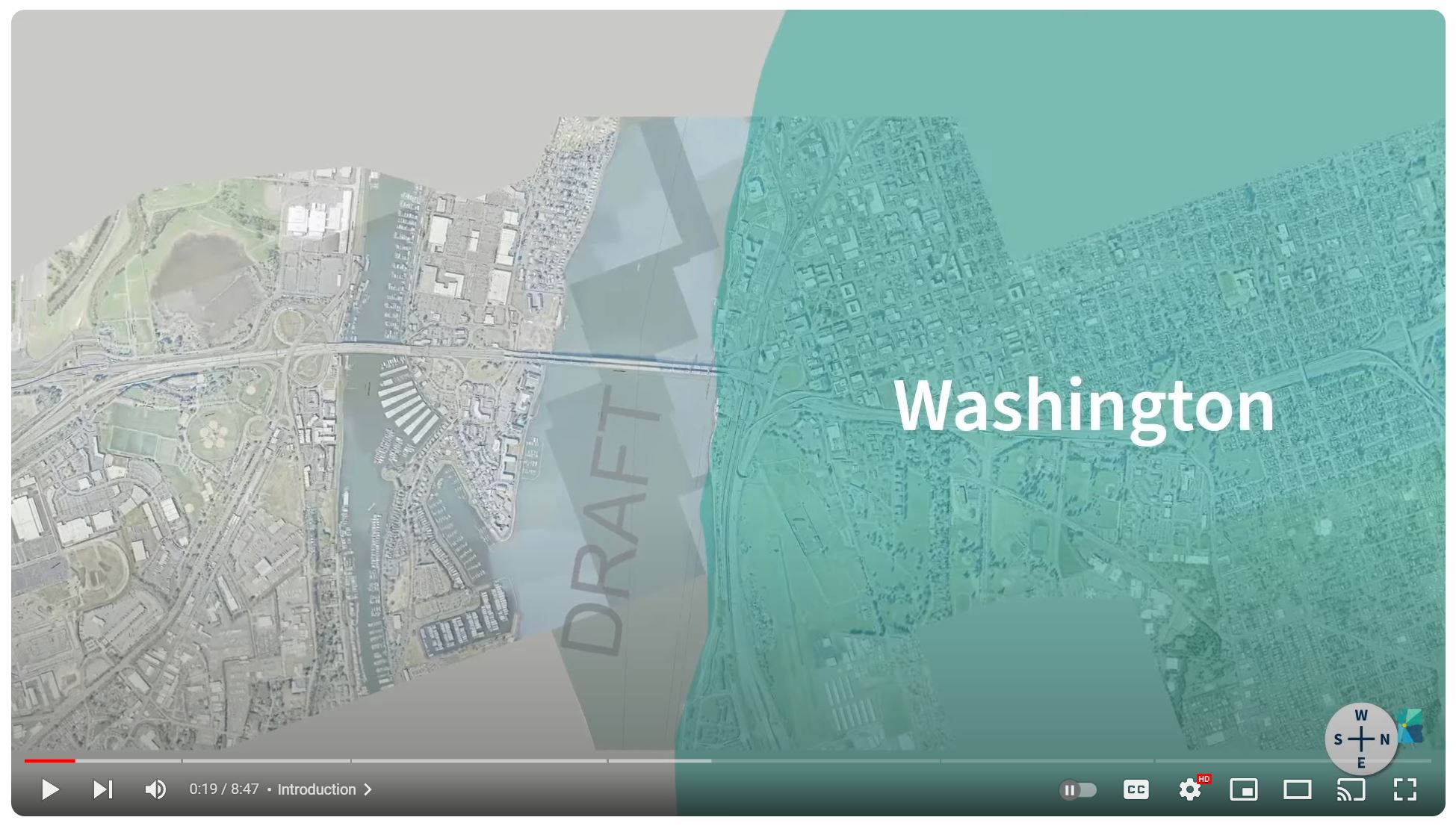
Washington | Existing Conditions & Proposed Investments
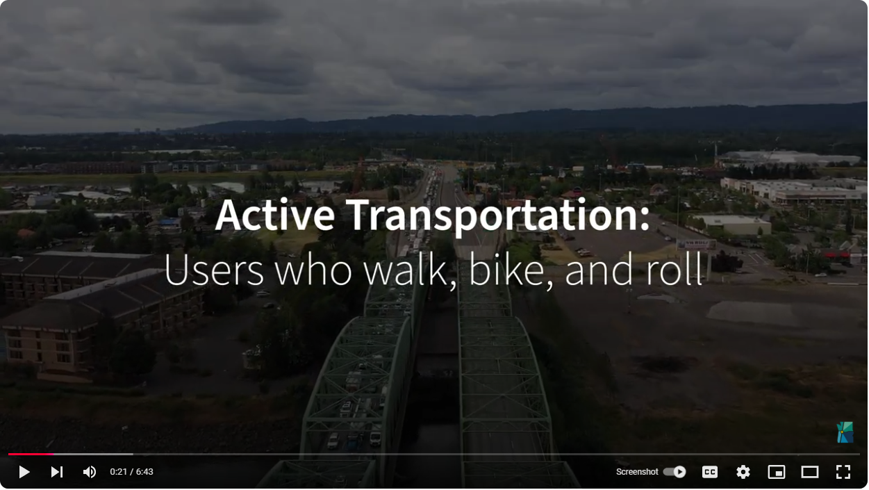
Active Transportation | Proposed Investments
Portland and Hayden Island
Program investments in this area will include upgrades to roadways, shared-use paths and public transit. That includes the extension of light rail from the Expo Center and a new transit station on Hayden Island. A rebuilt interchange at I-5 and Marine Drive paired with a new auxiliary lane will help address congestion and equalize the flow of traffic on and off the freeway. A new arterial bridge will make it so local traffic does not have to use the freeway to access the island. Investments in transit stations and roadway improvements underneath I-5 will help improve access across I-5. Improvements to connections for bikes and pedestrians will link to regional trails. Improvements to the interchange at Victory Boulevard will lengthen the on-ramp to untangle merging northbound traffic entering I-5. Southbound traffic entering the freeway from Marine Drive would also see a lengthened approach and merge with I-5 south of Victory Boulevard.
Click image to enlarge
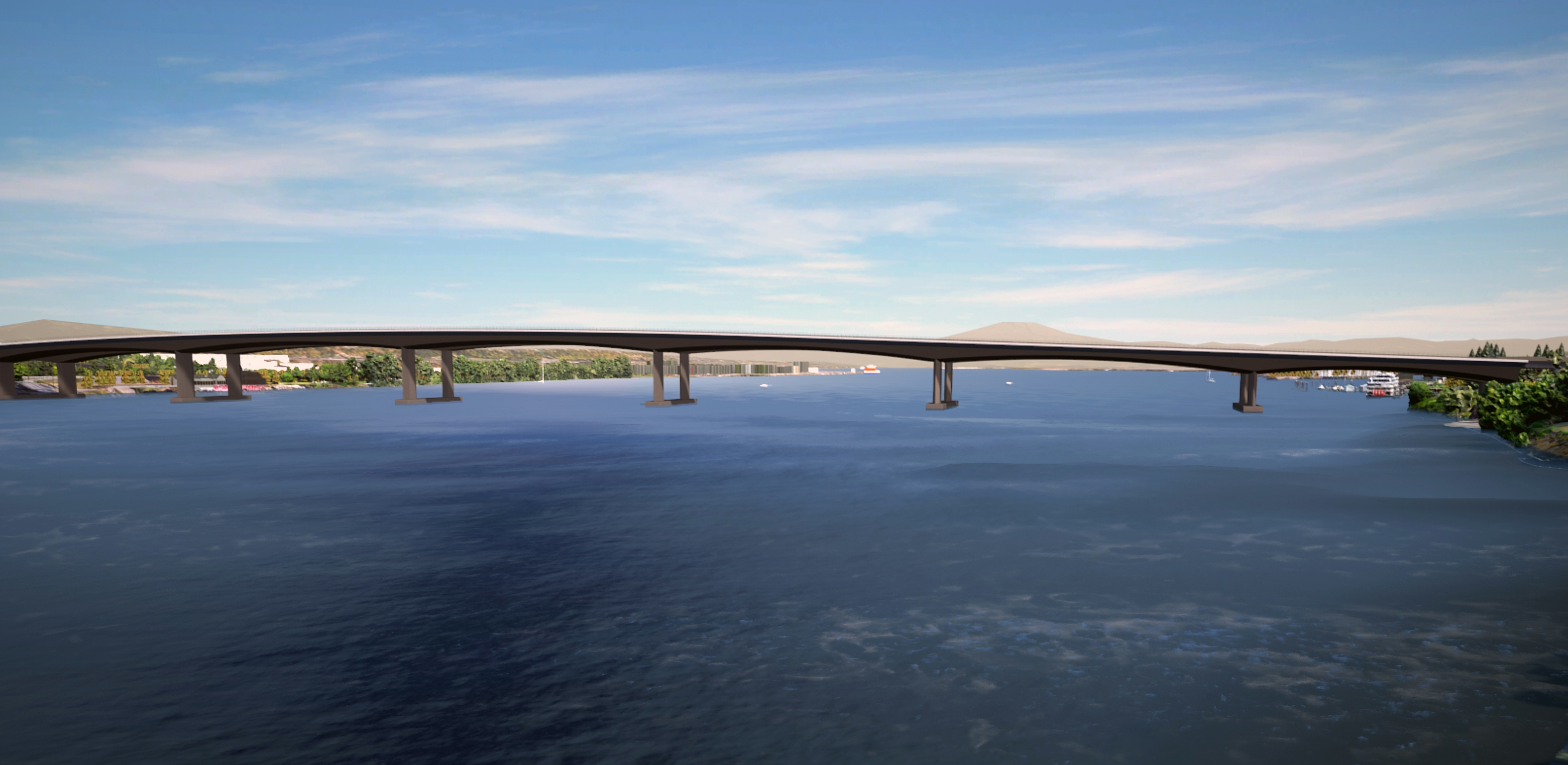
Columbia River Bridges
The replacement bridges will be safer and more accessible for freight and vehicles driving over the bridge, pedestrians and bike users. It will improve reliability for transit users across multiple modes, including light rail and express bus on shoulder. Whereas the existing bridges each have three lanes with no shoulders, the replacement bridge will be wide enough for three through lanes, one auxiliary lane in each direction, and shoulders on both sides of the roadway to improve safety and improve reliability for vehicle and freight traffic. Rebuilt adjacent interchanges on Hayden Island and downtown Vancouver will provide easier access for traffic to connect local roads such as Hayden Island Drive and C Street, and SR 14. The Program is pursuing a pair of single-level fixed-span bridges to replace the existing structures. The new eastern bridge would accommodate northbound traffic and a shared-use path, while the new western bridge would carry southbound traffic and two-way light rail. The bridge height will provide clearance for river traffic to navigate the river up to 116 feet.
Click image to enlarge
Downtown Vancouver
A waterfront light rail station will drop riders into downtown, while links to shared-use paths provide mobility for active transportation users. Parking at potential park and rides would be dispersed among up to 1,270 parking spaces across multiple facilities downtown. A community connector would cap a portion of I-5 at Evergreen Boulevard to help provide access for all users across I-5. An extension of light rail and a transit station near Evergreen Boulevard would give riders access to the new light rail extension and bus routes.
Click image to enlarge
Upper Vancouver
Reconstructed interchanges at Mill Plain Boulevard and Fourth Plain Boulevard will more efficiently facilitate traffic flow, including tall and wide freight traffic frequently traveling to and from the Port of Vancouver. Reconfiguration would preserve access from Mill Plain to Fourth Plain via a collector-distributor roadway, with the northbound off-ramp to Fourth Plain crossing over Mill Plain east of the freeway and functioning how it does currently. Improvements to the I-5-SR 500 interchange include reconstruction of the interchange to establish the beginning of the braided ramp to Fourth Plain and restoration of the loop connecting southbound freeway traffic to SR 500 via 39th Street.
Click image to enlarge
Next Steps
The IBR Program received an Amended Record of Decision from the Federal Highway Administration and Federal Transit Administration on July 1, which clears the way for the Program to finalize steps necessary to initiate construction. This includes securing the necessary permits, finalizing obligation of remaining grant funding and beginning the procurement process to identify a contractor to design and replace the bridge, with selection anticipated in 2027. Construction of the replacement bridge is currently anticipated to begin in 2028 and last for six to seven years.
Videos
Seismic Vulnerability
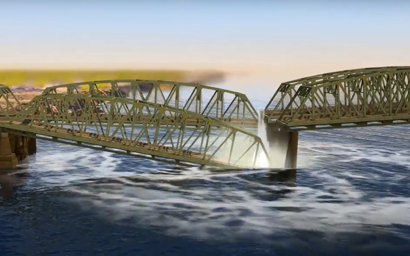
The Interstate Bridge is located near the Cascadia Subduction Zone, a 620-mile-long highly susceptible earthquake field. Learn more about how a major seismic event could affect the bridge.
Existing Conditions
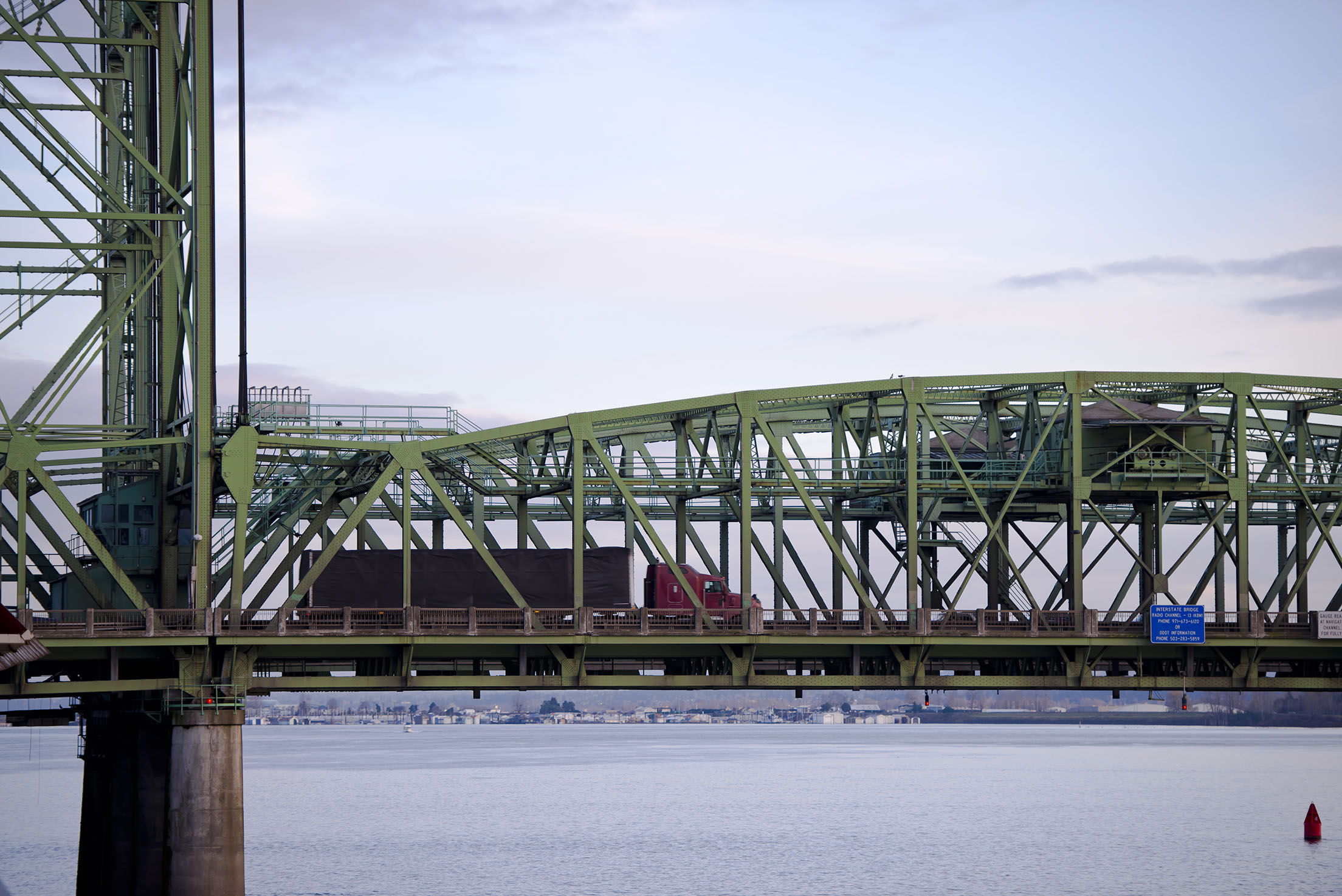
Located between Portland, OR and Vancouver, WA the Interstate Bridge is a vital connection that supports local jobs and families, and is a vital trade route for regional, national and international economies.
The Case for IBR
Provide Feedback
We need your help.
Join us in our effort to replace the Interstate Bridge. Your feedback is important in shaping a solution.
Submit a comment Share your story Attend a meeting